 NERC Data Catalogue Service
Rock stratigraphic unit
Type of resources
Topics
Keywords
Contact for the resource
Provided by
Years
Formats
Representation types
Update frequencies
Scale
-
The Lexicon of Named Rock Units provides definitions of lithostratigraphic, lithodemic, and litho-morpho-genetic geological units of the United Kingdom and its associated continental shelf. The Lexicon focuses mainly on units of Member, Formation, Group and higher rank (and equivalents) but it also includes information on some units of lesser rank, notably economically important coal seams and laterally extensive marine bands. It includes superficial and bedrock units. It includes synonyms and other names not currently recognised by the BGS or regarded as obsolete. Full Lexicon entries include geological unit name, a persistent unique identifier, map code, currency, rank, parent unit and rank, age, lithology, definitions of boundaries, thickness, previous and alternative names, geographical extent, type localities, and bibliographical references.
-
The Lexicon of Named Rock Units provides definitions of lithostratigraphic, lithodemic, and litho-morpho-genetic geological units of the United Kingdom and its associated continental shelf. The Lexicon focuses mainly on units of Member, Formation, Group and higher rank (and equivalents) but it also includes information on some units of lesser rank, notably economically important coal seams and laterally extensive marine bands. It includes superficial and bedrock units. It includes synonyms and other names not currently recognised by the BGS or regarded as obsolete. Full Lexicon entries include geological unit name, a persistent unique identifier, map code, currency, rank, parent unit and rank, age, lithology, definitions of boundaries, thickness, previous and alternative names, geographical extent, type localities, and bibliographical references. This dataset is a snapshot of the live database taken on the 30th April 2019.
-
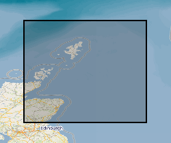
This dataset shows the distribution of Middle Jurassic, Upper Jurassic and Lower Cretaceous lithostratigraphic (UK Offshore Operators Association - UKOOA) units within the UK North Sea graben. The data are based on a subset of released exploration and appraisal wells from within the UK North Sea graben areas. The well data are concentrated in the areas overlying the deep sedimentary basins of the Viking Graben, Central Graben and the Moray Firth Basin, with fewer wells over the adjacent platforms. The UKOOA lithostratigraphic classification has been applied consistently.
-

The Lexicon of Named Rock Units provides definitions of lithostratigraphic, lithodemic, and litho-morpho-genetic geological units of the United Kingdom and its associated continental shelf. The Lexicon focuses mainly on units of Member, Formation, Group and higher rank (and equivalents) but it also includes information on some units of lesser rank, notably economically important coal seams and laterally extensive marine bands. It includes superficial and bedrock units. It includes synonyms and other names not currently recognised by the BGS or regarded as obsolete. Full Lexicon entries include geological unit name, a persistent unique identifier, map code, currency, rank, parent unit and rank, age, lithology, definitions of boundaries, thickness, previous and alternative names, geographical extent, type localities, and bibliographical references. This dataset is a snapshot of the live database taken on the 14th September 2017.